Professional Aerial Solutions
As a licensed drone operator based in Avondale, AZ, my passion is to provide top-notch aerial photography services that showcase the beauty of Arizona from a unique perspective. Let me elevate your visual content with stunning drone imagery that captures the essence of your project or business. Trust in my expertise to deliver exceptional results that stand out.
Choose excellence. Choose Desert Horizon Drone Services LLC.
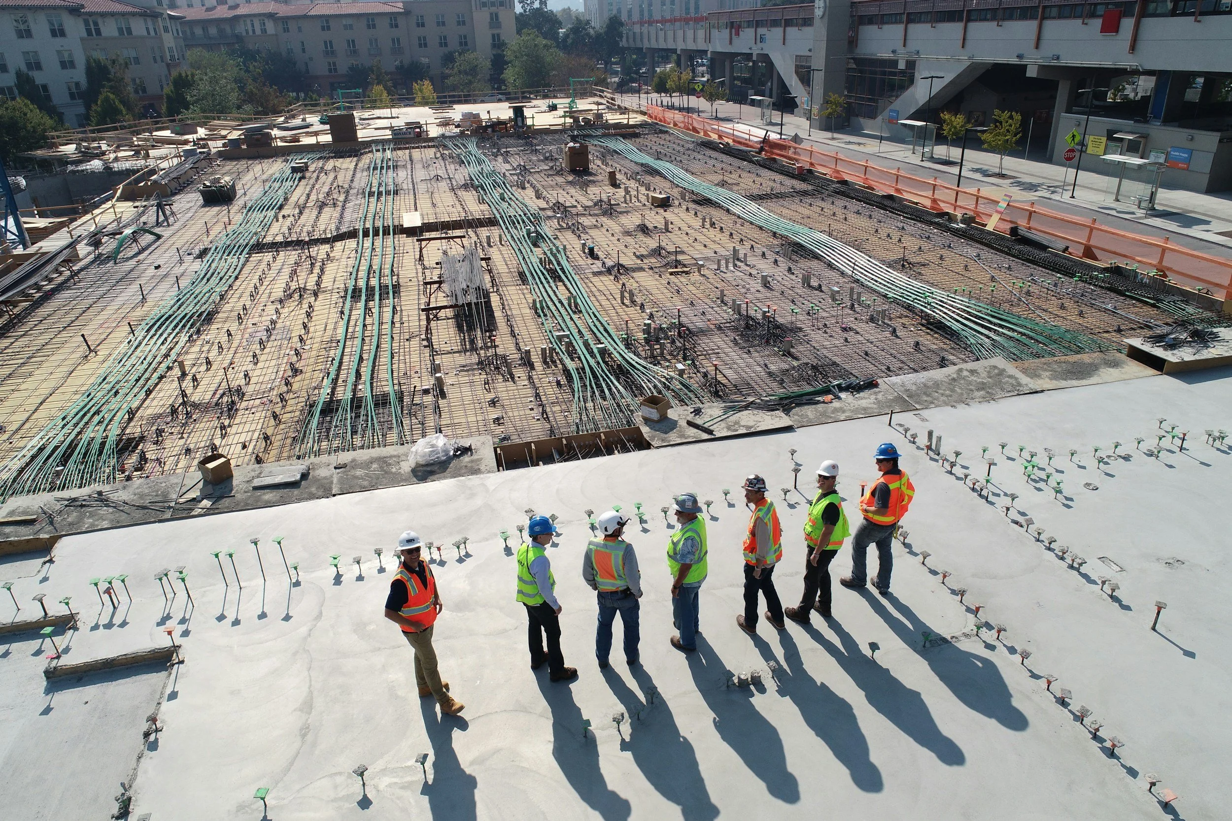
Construction Progress
At Desert Horizon Drone Services LLC, we specialize in capturing the dynamic evolution of construction sites through high-quality aerial photography. Our advanced drone technology provides a unique perspective on construction progress, allowing stakeholders to visualize the scale and details of their projects from above.
Benefits of Aerial Photography for Construction Progress
Real-Time Updates: Aerial images can be taken at various stages, offering a visual timeline of the construction process. This helps project managers and clients stay informed about progress and any potential issues.
Comprehensive Site Overview: Drones can cover vast areas in a single shot, providing an extensive view of the site, which is essential for evaluating the overall layout and development.
Enhanced Communication: High-resolution images can be shared easily with teams, clients, and stakeholders, facilitating clearer communication regarding project updates and changes.
Documentation: Regular aerial photography serves as a valuable documentation tool, creating a record of the project's evolution for future reference and reporting.
Our Services
Scheduled Progress Reports: We offer regular aerial photography sessions tailored to your construction schedule, ensuring timely updates.
High-Resolution Imaging: Our drones capture stunning high-definition images, providing you with detailed visuals for marketing, reporting, and archival purposes.
Customizable Packages: We provide various service packages designed to meet the specific needs of your construction project, from initial ground-breaking to final completion.
For a professional and detailed approach to documenting your construction progress, choose Desert Horizon Drone Services LLC. We are dedicated to delivering exceptional service and imagery to ensure that your project is showcased in the best light.
Aerial Imaging & Filming
Aerial imaging and filming have truly revolutionized the way we capture and convey compelling visual narratives. By utilizing the latest advanced drone technology available in the industry, we provide high-resolution images and videos that showcase unique perspectives and stunning landscapes that were previously difficult to achieve. Our wide range of services is ideal for a variety of applications, including real estate marketing, event documentation, construction site monitoring, and much more. Our licensed drone operators make use of state-of-the-art equipment to ensure exceptional quality and safety standards during every flight. We genuinely understand the importance of capturing the right moment, which is why we work closely with our clients to tailor each aerial shoot to fit their specific needs and goals seamlessly.
From sweeping landscapes to intricate detailed close-ups, our comprehensive aerial imaging services can highlight the beauty and intricacies of any project in remarkable ways. With a keen eye for composition and an expert understanding of lighting conditions, we deliver visually striking results that engage and impress viewers. Whether you are looking to enhance your marketing materials, document a significant event, or meticulously track progress on a construction project, our aerial photography and videography services offer a professional and innovative solution that can't be overlooked. Trust Desert Horizon Drone Services LLC to elevate your visual storytelling and showcase your unique vision from an incredible vantage point high above.
Aerial Mapping
Aerial mapping leverages drone technology to capture high-resolution images, creating detailed maps essential for construction, agriculture, and land surveying. Using advanced UAV systems, we gather precise geographical data quickly and efficiently, providing accurate topographical information for informed land use, project planning, and resource management.
Benefits of Aerial Mapping:
Enhanced Accuracy: High-resolution drone imagery captures details often missed by traditional methods.
Cost-Effective Solutions: Reduces the need for extensive ground surveys, lowering project costs.
Comprehensive Data Collection: Produces visual outputs and integrates data sets like elevation and vegetation health.
Time Efficiency: Covers large areas much faster than conventional methods, speeding up project turnaround.
Accessibility: Reaches difficult locations safely, ensuring thorough data collection.
At Desert Horizon Drone Services LLC, our aerial mapping services are tailored to your specific needs, utilizing cutting-edge technology to deliver exceptional results for successful project execution.


